Previous section: Introduction
El Chocó
[The] Chocó is an ecological region that spans from the Darién gap in the north on the Colombian border with Panama, down into northern Ecuador in the south. It lends its name to the Colombian Departamento del Chocó which covers its central portion, though Colombians use the term Chocó as short-hand for the entire pacific coast. It is part of a broader Isthmo-Colombian forested region that covers the junction of Central and South America.
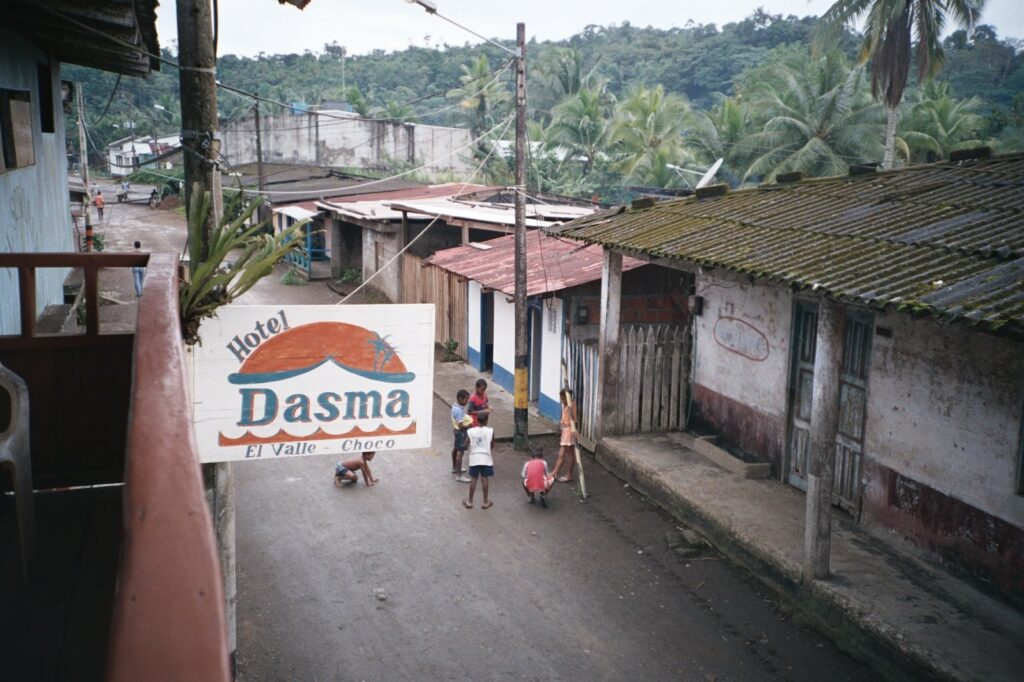
The Chocó is the center of Afro-Colombian culture, as well as modern Indigenous communities like the Emberá. It is also one of the poorest and least developed places in Colombia, and has suffered greatly in Colombia’s internal armed conflicts. Most travel is done by river.
Weather gauges in the Department of the Chocó receive about 8 to 13 thousand millimeters of rain total in a year, which lines up nicely with the ERA5 data in the introduction showing an inch of rain on average every day across the whole region. This far surpasses most other tropical environments, and requires some additional explanation.
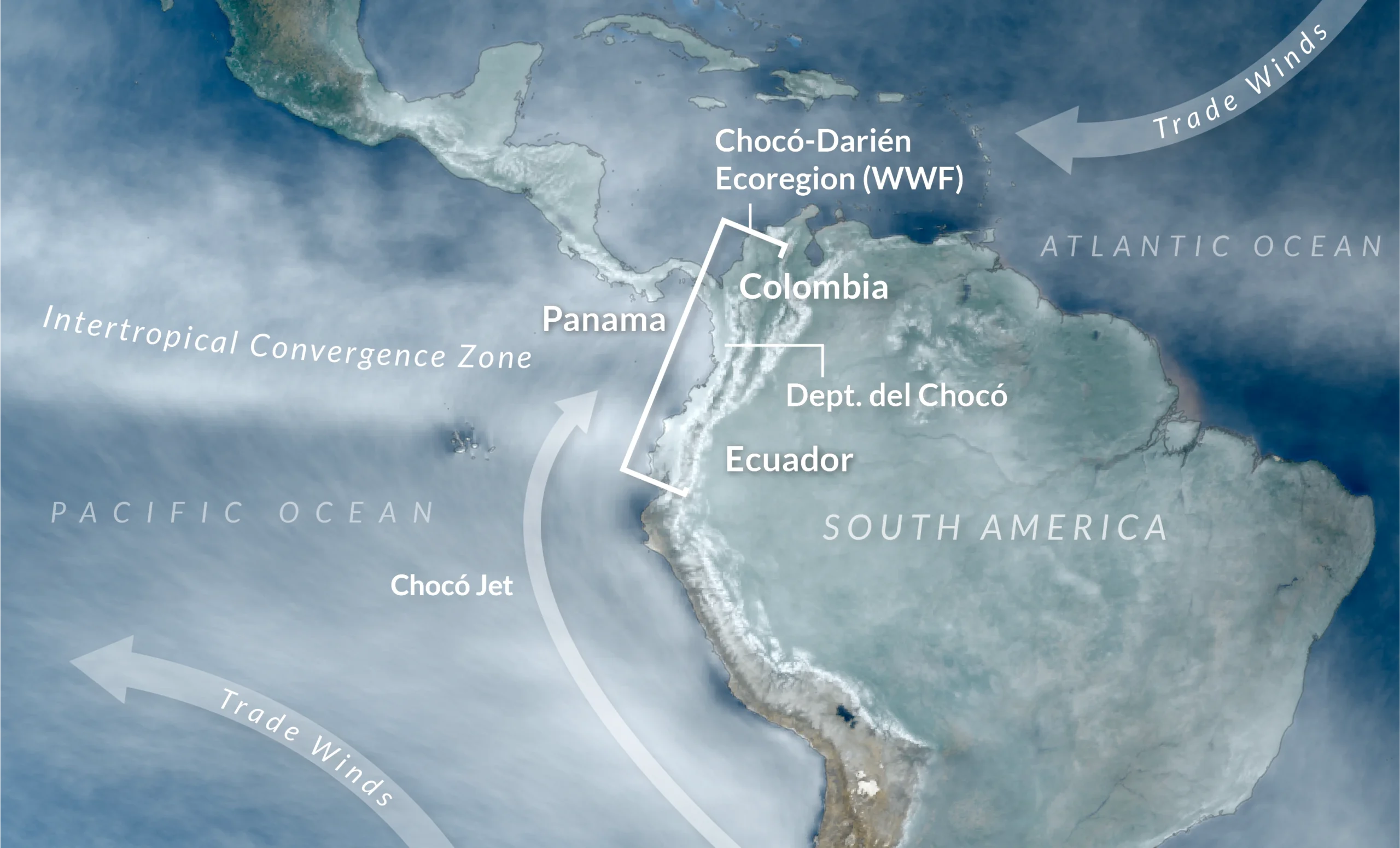
Broadly, one reason the tropics are as rainy as they are is because they are close to the equator where global winds from the north and south collide, producing a band of perpetually muggy, wet weather called the Intertropical Convergence Zone (ITCZ). This band swings wildly north to south in some places, but stays fixed over the Colombian coast year-round, where it interacts with a regional wind called the Chocó Jet.
A ‘jet’ in meteorology is a wind that blows close to the surface, and therefore can be easily blocked by surface terrain features. The Chocó Jet rises off the coast of Chile, where global winds otherwise broadly turn away from the land, but the Chocó Jet curves back eastwards, and slams right into the Colombian Andes. The mountains force the jet upwards where it collides with northern and western winds passing from the Caribbean. The interaction between the Chocó Jet, ITCZ, and these Caribbean winds means the Chocó has two dry-wet cycles per year, with the strongest wet season around October.
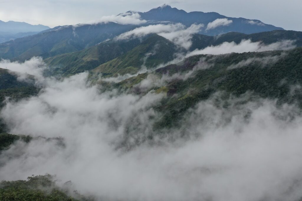
These atmospheric forces combined would by themselves lead to a very wet climate but the Chocó has two more local features that push it to global extremes. The Andes here curve eastwards, acting like a funnel that concentrates the winds as they move inland. As their slopes become overgrown with vegetation, plants ricochet water droplets against each-other, causing what some scientists have dubbed the Lluvia Horizontal (lit. horizontal rain), a dense fog that covers the most forested areas.
It has even been theorized that dense forests, like those that cover the majority of the Chocó, release so much water vapor that they can alter weather patterns on a regional scale – called the Biotic Pump theory, driving clouds and rainfall that would not exist otherwise. This perhaps explains why the Chocó Jet veers so sharply right, but this is still all under active investigation, and I am not a climatologist.
I did read about other places that regularly top out rainfall records, like some towns in northeastern India, but the Chocó is unique in that it is both relatively rainy year-round (instead of having a dry season between extremely wet periods), but it is also large – larger than South Carolina. I had definitely found my spot, but now came the challenge of actually mapping it out.
Next section: Making Mosaics